Tuesday – and Richard shows up. I’m still putting the diff into the Landy as he arrives, and the wiring for the dual battery and the ARB compressor still needed to be done. Worked late and then called it a night with just the wiring to go.
Wednesday – the day we are meant to leave. Start the wiring and get it completed just before lunch. Took it for a test drive and rear diff sounded real bad. Quick diagnosis reveals that shims are incorrect. So out comes the rear diff again. Re-shimmed it and placed it back in. Did the test drive and all sounded good. Packed up the Landy and we hit the road at 4pm – Oops.
Travelled down to the Hume Weir and called it a night there. Not quite where we were aiming for, but at least we got on the road. Had a bite to eat on the way through Albury, so it was a quick set-up and straight to bed.
Thursday – woke up to some serious fog. Drove down the side of the Hume Weir and started to head for Mitta Mitta. Arrived and had a quick look around before continuing on.

Started on the trek towards Wombat PO and all was fairly easy. Got up to the top of the hill and started a fairly steep downhill part (Wombat Creek Track) – actually engaged low range and nearly got excited. We made our way down to the hut and set up for lunch. The hut wasn’t in very good condition inside – people had been abusing the privilege which is a shame.


Continued on to Omeo to get some shopping out of the way. There are some nice camping areas along the side of the Mitta River (Kellys Road) and it’s not a bad drive on top of it. After fueling up and getting some shopping done, we headed off to Benambra. Had to stop as good old me forgot to fuel up the gas bottle. With that done we continued on to Buenba Flat to set up camp for the night. Let me tell you – that was one bloody cold night too. However it is a pretty damn good spot by the river.


Friday – woke up to frost and some bloody cold weather. Pulled down camp, fed the kids and hit the track by around 10am. Headed up Buenba Rd bound for Mt Gibbo. When we turned onto the Mt Gibbo track, it didn’t look like it was used all that much – which is a wonder as it’s a bloody good challenge in places with some spectacular views. The climb up to Mt Gibbo was fairly steep with some minor mud on the track. Richard didn’t use his, but I engaged the rear locker as I was slipping a little. Plus I wanted to test the new toy out (still haven’t used the front in anger yet). With Mt Gibbo at 1750m, it is actually higher than Mt Pinnabar (1712m).


From there we continued on through Mt Anderson


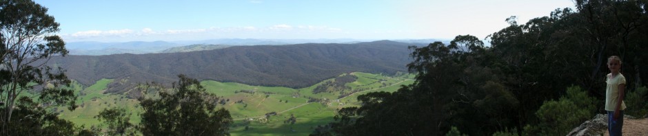
on to Mt Pinnabar for lunch. This was a relatively easy enough drive, but was conducted fairly slowly due to the views from the top of the ranges – some of the best I’ve seen next to Tassie. Mt Pinnabar was a bit fresh but the view across to Mt Kosciuszko covered in a bit of snow was pretty damn good. Had lunch and started making our way down Mt Pinnabar track towards Dogman Hut (Tom Groggin area).


I was starting to be feeling a little discouraged, as I had heard a lot about this track being scary in the wet. Now it wasn’t raining or anything, but it was certainly cold enough and there was some areas that still hadn’t had any sun on it by then. The start of the track is very easy. But then towards the end it suddenly became all clear. It was quite funny, as obviously someone before us had been through and there were tyre marks all over the place from them slipping and sliding there way down.
We made it down the bottom easily enough, getting some firewood on the way. The sign for Dogman Hut is down which threw us a little. We ended up at the Murray River crossing and the sign pointed back towards the way we had come. So we did the obligatory crossing which wasn’t too bad, and then back tracked.


Found the hut and set up camp. It was only 1530 so it was a good day time wise.

Dogman Hut was a good little area to camp. Good river, good fire area and even better good flat grass. Noticed in the book that the last entry was complaining about the track down from Mt Pinnabar!!!


According to the sign at the start of Davies Plain track, it is closed from May through to December. So not being too sure, we decided to give it a miss. Which ended up lucky for us anyway, as due to some unfortunate ‘toilet’ accidents that night, we need to get to a town anyway.
Saturday – we crossed the river back into NSW and headed off towards Thredbo. Got a shock when we found a little bit of snow up the top of the range. Stopped and let the kiddies have a play (they’d been nagging me about snow all trip) and then continued on.


Had lunch at the pub and did some shopping, then took the kids over for a play.


Ended up leaving about 1430 to head back up the road.
Had some problems with the Landy on the way back down the hill. Suprisingly it must have a small leak on the front left wheel. So with some oil on the brake and a lot of really steep downhill sections, there was a little bit of smokage happening!!! So I let it cool for a little while and then just went down the hill in second instead. Continued on to the Geehi rest area.
The initial impression of Geehi was really good. It looked clean, well looked after and a great river. The river crossings were relatively easy enough, but the water level was down a little. We ended up finding the Old Geehi hut empty, so we set up camp there for the night. What a great set up. Open fire place and plenty of room – we had a great night. Tried a bit of fishing again, and again no luck. Had a good nights sleep – and was fairly warm on top of it.


Sunday – headed of towards Major Clews hut. There are a couple of good areas in there requiring low range (or plenty of braking in high range) and some good views. Major Clews hut has a lot of information about the Major which is a good read. I recommend it to anyone passing through.

On the drive out the trail, there was a tree down that required you to drive bloody close to the cliff edge to get around it. Was a few moments of no breathing happening but all’s well that ends well.
Drove from the intersection at the Alpine Way through Khancoban to Tumbarumba.

Got some lunch and continued on our way. Went down into Paddys River Dam and had a look. This would be a good area to set up camp for a little while. Has the drop toilet for the girlies and the dam for us.

From there we followed Stockmans Creek Road to Buddong Hut. Had us wondering for a while if we where on the right track, and it certainly got interesting in a few places. However we found the hut and got the obligatory photos on top of it. Coming out we had to negotiate a few mud puddles which dirtied the cars minorly and continued making our way to Buddong Falls.


It is just a little over 1km to Buddong Falls return (walking) – and trust me it felt like it. The track actually continues along for a little longer to more falls lower down, but energy levels and time of day weren’t that good.


We turned onto the Powerline Trail and followed it down to the Talbingo Resevoir. This dropped nearly 1000m in a very short time, however it had some great views along the way. It is an easy enough road and you could get a Falcon etc down there, it’d just play havoc with your brakes.
Spent some time around Talbingo Reservoir and the Tumut 3 power station getting some photos.


We then made our way up the road to Tumut where we said our goodbyes to Richard. I will say that having Richard along was a pleasure, and he had some damn good patience with the trip – that being the Landy not ready initially, the 3 kids and the changes to plans due to track closures etc. Thankyou for your company Richard.
And sadly we had to continue on home as I have to work tomorrow.
All of the photos are at: [url]www.4wdlinks.com.au/gallery/cewilson[/url]
Cheers
Chris